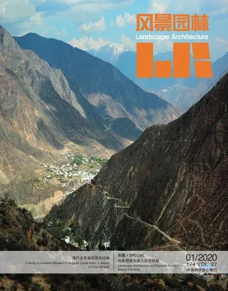
中国的国土景观
2020-12-01王向荣

国土上既有山水林田湖草等自然资源,又有人类活动建造的城镇、村庄、工厂、矿山、道路等人工设施。不同的自然资源和人工建设构成了国土上不同的景观,这些景观是既有的国土空间利用方式的表现,也是未来对国土空间进行规划管理的前提。因此,在国土空间规划管理的巨大变革时期,作为风景园林的从业者,我们应该更加深入地了解、认识和研究中国的国土景观。
我曾于2002年在柏林购买了德国学者Johannes Mueller出版的《中国的文化景观》(Kulturlandschaft China)一书。作者对当时中国的国土景观进行了初步的区域划分,也对每个区域景观的形成和现状做了基本描述,书上的图片和图纸反映了20世纪80—90年代中国的景观面貌,这本书激发起我随后研究中国国土景观的兴趣。
一个国家领土范围内地表景观的综合构成了这个国家的国土景观。中国疆域辽阔,大陆东西横跨62经度,南北纵跨33纬度,拥有多样的地形、地貌、气候、温湿、动植物等自然条件,不同状况的自然条件叠加又形成了更多样的地域自然环境。
中国国土整体地势呈三级台阶状分布,自西向东依次递减,既拥有海拔8 844 m的地球上最高的珠穆朗玛峰,亦有低于海平面154 m的吐鲁番盆地中的艾丁湖。中国大陆具有寒带、温带、亚热带、热带等不同的气候带。年均降雨量从华南一些区域的超过2 000 mm到吐鲁番盆地的不足20 mm不等,有湿润、半湿润、半干旱、干旱等不同的地区。中国也是世界上拥有河流和湖泊最多的国家之一。随着地形地貌、气候类型、温湿条件的不同,植被类型与分布也千差万别,并形成不同的自然生态系统,包括森林、湿地、草原、荒原、沙漠等。多样的自然地理环境是形成中国国土景观独特性和多样性的自然基础。
中国又是历史悠久的文明古国,经过几千年来的劳作实践,中国人在不断摸索中掌握了适应本土环境特点的生存发展方式,根据地方的自然条件和风俗习惯,发展农业,营建家园。为了适应地域自然条件,人们采用不同的方式改造环境,种植作物,建设配套的水利设施,整理出多样的农业耕种类型。同时人们依据地理环境、自然资源、社会架构和生产生活方式,就地取材,建造房屋,创造出不同的建筑类型,在此基础上形成各具特色的村落和市镇。每个地区的农业与聚落相对稳定,世代沿袭,经过漫长的时间积累,形成了一个个在时间上延续、在空间上完整的景观单元,这些千差万别的景观单元延绵覆盖于地表,形成了多样的景观面貌。
复杂多变的自然条件与源远流长的人文历史共同塑造了中国独特而丰富的国土景观,使得国土空间不仅仅是物质空间,也成为中国人的精神家园。历史上,无数诗词歌赋和山水画作描绘了中国的山峦、河湖、原野、田园、村庄、城镇、寺庙、园林,中国的国土景观影响了中国人的哲学、思想、文化、艺术、行为和价值观。
今天,国土空间规划体系的建立能够促使我们将国土上的自然和人文资源视作一个整体来保护和发展,但是成效如何却取决于我们对于国土上这些资源的认识程度。吴良镛先生在《中国人居史》一书中指出:“今日中国之土地是古人数千年辛苦劳作、悉心化育逐渐形成的,凝结了古人世代心血的经营与辛勤汗水的浇灌,也凝结了探索具有中华特色可持续发展人居文明的艰辛历程。作为一个中国人,自当对前人艰辛创造人居环境的历史有所体会,有所尊重;自当对于中国之土地有一分崇敬,有一分深情”。我们需要对国土空间有整体和深入的研究,认识其演变、现状和未来发展的趋势,采取合适的对策,保证在社会和经济快速变革的过程中,经由漫长历史岁月沉积下来的国土上的自然和人文遗产仍然受到珍视,每一片土地的景观独特性能够持续,景观的多样性能够得到维护。
主编:王向荣教授
2020年1月3日
PREFACE
The Territorial Landscape of China
On our vast territory, there are natural resources such as mountains, rivers, forests, farmlands, lakes and grasslands, and artificial facilities such as towns, villages, factories, mines and roads built by human activities. Different natural resources and artificial constructions constitute different landscapes on the land, which can be seen as the performance of how people utilize the existing land and space, and also the premise for the planning and management of the land and space in the future. Therefore, in the period of great transformation of land space planning and management in China, we, as practitioners of landscape architecture, should deeply understand and study the territory landscapes of China.
I bought the book -Kulturlandschaft Chinapublished by Johannes Mueller, a German scholar, in Berlin in 2002. The author made a preliminary region division of the landscapes in China at that time, and also gave a basic description of the formation and current situation of the regional landscape. Pictures and drawings in the book reflected the landscape of China from the 1980s to the 1990s. This book arouses my interest in studying the landscape of China.
A combination of surface landscapes within a country’s territory constitutes the country’s territory landscape. China has a vast territory spanning 62 longitudes from east to west and 33 latitudes from south to north. There is a variety of topography,geomorphology, climate, temperature and humidity, plant and animal species. Different natural conditions are superimposed to form a diverse regional natural environment.
The overall land topography of China is three-step-like,decreasing from west to east, with the highest Mount Everest on the earth at 8 844 m above sea level and Aydingkol Lake in Turpan Basin at 154 m below sea level. There are different climatic zones such as cold zone, temperate zone, subtropical zone and tropical zone on mainland China. The average annual rainfall ranges from more than 2 000 mm in some regions of South China to less than 20 mm in the Turpan Basin. There are humid, semi-humid, semiarid, and drought areas. China is also one of the countries with the most rivers and lakes in the world. With various topography, climate type, temperature and humidity conditions, vegetation types and distribution are also very different, and different natural ecosystems are formed, including forests, wetlands, grasslands, wasteland,deserts, etc. The diverse natural geographical environment is the natural basis for the formation of the uniqueness and diversity of the territory landscapes of China.
China enjoys a long history of ancient civilization. After thousands of years of practice, the Chinese have mastered the survival and development mode adapted to the local environment,and can develop agriculture and build their homeland according to local natural conditions, customs and habits. In order to adapt to the natural conditions of the specific regions, people have been transformed the environment, planted crops, built supporting water conservancy facilities in different ways and sorted out various ways of agricultural cultivation. At the same time, people use local materials to build houses and create different types of buildings according to the geographical environment, natural resources, social structure, production mode and life style. The villages and towns of different characteristics are formed on this basis. The agriculture and settlement of each region are relatively stable and inherited for generations. After a long time of accumulation, the landscape units that are continuous in time and integrated in space are formed.These diverse landscape units spread over the land surface, forming a variety of landscape features.
The complex and changeable natural conditions and the longstanding human history have shaped unique and rich landscapes in China, it is not only the material space but also the spiritual home of the Chinese people. Historically, countless poems and landscape paintings have depicted the mountains, rivers, lakes, farmlands,grasslands, villages, towns, temples, gardens, the landscapes of China have influenced the philosophy, ideology, culture, art,behavior and values of the Chinese people.
Today, the establishment of the territorial spatial planning system can encourage us to protect and develop the natural and human resources of the land as a whole, but the effectiveness depends on our understanding of these resources on the land.Mr. WU Liangyong pointed out that in his bookThe History of Chinese Human Settlements: “The land of China was gradually formed by the ancients after thousands of years of hard work and careful management, which condensed the ancient people’s painstaking efforts and hard sweat, and also the winding road of exploring the sustainable development of human settlement civilization with Chinese characteristics. As a Chinese, we should experience and respect the history of human settlement and the land of China.” We need to have an overall and in-depth study of the land, to understand its evolution, the current situation and the trend of future development, and to take appropriate countermeasures to ensure that the natural and human heritage that has been deposited over the course of the rapid social and economic change is still valued, the landscape uniqueness of each piece of land can still be sustained and the diversity of the landscape can be preserved.
Chief Editor: Prof. Dr.-Ing. WANG Xiangrong
January 3rd, 2020
