SuperView-1 03/04 Launched Atop LM-2D
2018-02-20WANGXu

SuperView-1 03/04 satellites are being launched atop a LM-2D
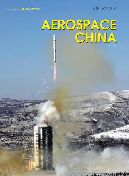
China launched SuperView-1 03/04,a pair of satellites, with a LM-2D carrier rocket from the Taiyuan Satellite Launch Center at 11:24 Beijing time on January 9, 2018. The networking operation of 01/02 and 03/04 satellites marks the completion of the first phase of China’s first 0.5 m-level high-resolution commercial remote sensing satellite constellation.This was China’s first launch in 2018.
SuperView-1 was developed by China Academy of Space Technology(CAST). China Siwei Surveying and Mapping Technology Co., Ltd (China Siwei) under CASC, is responsible for its commercial operation.
With the networking of the first four 0.5 m-resolution optical remote sensing satellites, the SuperView-1 system will achieve 10 minutes imaging per orbit,rapid download and be able to collect 300 km2images per day, providing highlevel and 24-hour remote sensing data and application systems service solutions for global users.
The SuperView-1 01/02 satellites were launched on a LM-2D carrier rocket on December 28, 2016 and began to officially provide commercial remote sensing services from April 2017.SuperView-1 has collected more than 225, 000 global images covering 24.56 million km2and provided services for many industries in mapping, land and resources survey, urban construction, agriculture, forestry and water conservancy,plus geology and mineral resources.

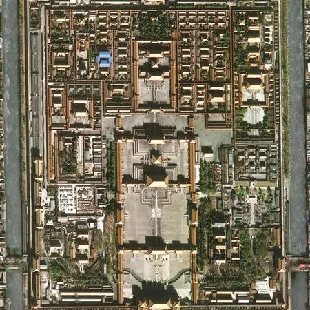
SuperView-1 03/04 satellite images of Dubai (left)and the Palace Museum (right)
It was reported that SuperView-1 strongly supported the monitoring of the reduction in productivity of the steel industry and provided satellite remote sensing data for the 3rd agricultural census in China. The cooperation between Chinese commercial remote sensing satellite operator and the Arctic high-latitude Earth station is now officially initiated after the signing of the Arctic station service contract with the Norwegian company,Kongsberg Satellite Services AS.
China Siwei has developed the international satellite data distribution market and signed cooperation contracts with more than 20 foreign sale agencies within 17 countries on five continents.
The SuperView-1 commercial remote sensing satellite system also has huge application potential in the internet,smart city, financial and insurance industries. It will help in strongly promoting remote sensing technology applied in government management, for businesses and in public life through the integration with the mobile internet, navigation and positioning, intelligent terminal and virtual reality applications.
SuperView-1 03/04 satellites sent back the first HD images which are the best compared with other domestic and top-class international equivalents,successfully signifying the completion of China’s four satellites network of 0.5 mlevel high-resolution commercial remote sensing satellite constellation.
The acquisition ability will be greatly improved due to the network. The constellation will be able to provide images of any location in the world and refresh images of 80% of any location in the world in every 24 hours. The capture and transmission will at the same time improve the on-orbit image transmission efficiency.
杂志排行
Aerospace China的其它文章
- China Sets Up Three Technical Approaches for Reusable Rocket Engine
- Yaogan 30-04 Set Satellites Launched
- CNSA Satellite Assembly Integration & Test Center Established
- Tiangong 1 Target Spacecraft Returned to Earth
- China to Build and Launch Cambodia’s First Communications Satellite
- China’s First High-Throughput Satellite Put into Operation