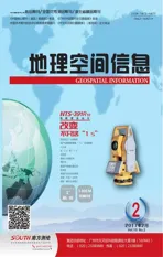
《地理空间信息》期刊被指定为湖北省测绘学会与英国皇家测量师学会合作项目官方交换刊物
2017-03-02
《地理空间信息》期刊被指定为湖北省测绘学会与英国皇家测量师学会合作项目官方交换刊物

Geospatial Information was designated as an official exchange publication in the cooperation projects between Hubei Province Society for Geodesy, Photogrammetry and Cartography and the Royal Institution of Chartered Surveyors
协议签订仪式
Agreement Signing Ceremony
《地理空间信息》编辑部
Editorial Department of Geospatial Information
2012年6月29日
June 29, 2012
日前,英国皇家特许测量师学会(RICS)与湖北省测绘学会在武汉签署合作协议。湖北省测绘局相关领导出席仪式。英国皇家特许测量师学会亚洲区商务发展总监Darren Jensen先生、湖北省测绘学会理事长张建仁同志分别代表双方在协议书上签字。
A few days ago, the Royal Institution of Chartered Surveyors (RICS) and Hubei Province Society for Geodesy, Photogrammetry and Cartography signed a cooperation agreement in Wuhan. Leaders of Hubei Bureau of Surveying and Mapping attended the ceremony. Mr. Darren Jensen, a director of business development in RICS Asia, and Mr. Zhang Jianren, the president of Hubei Province Society for Geodesy, Photogrammetry and Cartography, representing the two sides signed the agreement.

协议规定双方将实行会员资格互认,并以出版物交换、专业信息交流及建立高层互访等途径以促进双方的相互了解。根据协议,《地理空间信息》期刊被指定为湖北省测绘学会与英国皇家特许测量师学会合作项目中唯一的官方交换刊物,为促进湖北省测绘行业的国际合作与交流,加强专业技术人员之间的学术沟通、推动其专业技术水平的提升搭建信息平台。
The agreement stipulated that both sides would implement the mutual recognition of membership, and exchange publications, professional information and leaders' visits to promote mutual understanding. According to the agreement, Geospatial Information was designated as the only official exchange publication in the cooperation projects between Hubei Province Society for Geodesy, Photogrammetry and Cartography and the Royal Institution of Chartered Surveyors, which built an information platform to facilitate international cooperation and communication in the surveying and mapping field in Hubei Province, promote academic communication among professionals and improve their professional standards.
王燕云
《地理空间信息》编辑部WANG Yanyun
Editorial Department of Geospatial Information
杨丽
湖北省基础地理信息中心YANG Li
Hubei Geomatics
Information Center
